IMAGE
Traditional Use and Influence Map Item Info
- Title:
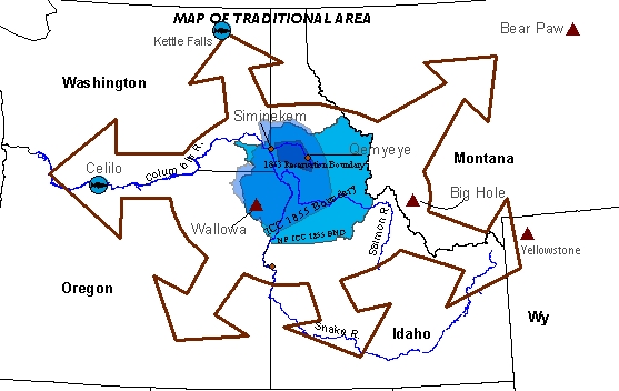
- Traditional Use and Influence Map
- Description:
- illustrating the extent of aboriginal use and influence (from Celilo Falls to Kettle Falls on the Columbia River, from the Yellowstone region to the Lower Snake River area), and the successive reservation boundaries established by the Treaties of 1855 and 1863, as well as the Indian Claims Commission (ICC) boundary. Note the reference to the Bear Paw and Big Hole Battle sites, part of the Conflict of 1877.
Source
- Preferred Citation:
- "Traditional Use and Influence Map", Nimíipuu L3, Center for Digital Inquiry and Learning (CDIL)
- Reference Link:
- https://cdil.lib.uidaho.edu/nimiipuu-l3/items/nimiipuu-l3-028.html