Land
from Sedimentation: An Archive of Glen Canyon
LAND
Terra Infirma
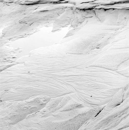
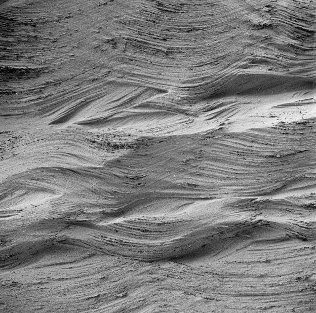
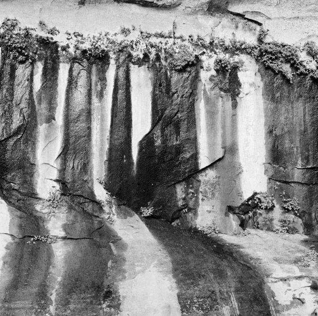
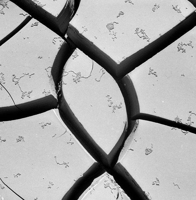
GLEN CANYON IS a landscape in constant motion. Here, the contours of space rarely hold still: bits of earth – sediment, rock dust, sandstone shards – are at all times sloughing away from their bedrock encasings, etched out by wind, water, animal foot, or plant root.
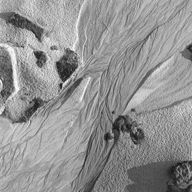
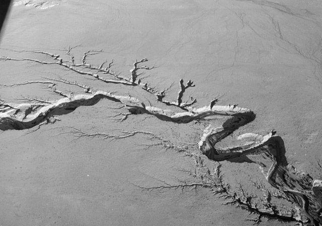
Some of these loose bits are plucked up by wind and set down in the crevices of the canyon’s rilled buttes, hills, and cliffs; others pile up into high dunes. Some bits are taken up by water – carried by a trickle of rain or the Colorado River itself – to heap up on a sandy shore, or to lodge along the river’s bed. So the edges of things waver and drift, and the ground swells and subsides, like a viscous, slow-moving sea.
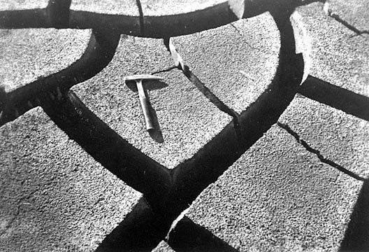
This is not terra firma, solid earth, fixed space – this is a terrain always in flux. Fissures, cut by flowing water, worm through the soft sandstone ground; some fissures widen into canyons, and then splinter into branches. For as long as these canyons exist, they will meander and writhe like great sluggish snakes.
Of course, all landscapes shift over time. Elementary children can tell you that mountains rise and crumble, that rivers carve valleys and deep canyons, and that tectonic plates will eventually tear the continents apart and push new ones together. But barring natural catastrophe – earthquakes, volcanic eruptions, landslides – these mutations have, for centuries, been imagined to take place at such a gradual, creeping pace that they are nearly imperceptible, and therefore inconsequential, for human life.
We have come to expect, in other words, that the ground will remain firm beneath our feet.
But not all humans view nature as inert and inanimate. Author Amitav Ghosh reminds us that this is a Western way of thinking, and even within Western culture, gradualist ideas only gained prevalence at the turn of the 19th century, when geologists James Hutton and Charles Lyell began propounding ideas that the earth was formed not through a series of violent calamities, but by incremental accruals, erosions, and shifts. The theory stuck, in part because Lyell slandered his detractors as primitive and susceptible to mystical thinking.1 Those who believed in a more capricious earth, Lyell said, were effectively ascribing natural processes “to the intervention of demons, ghosts, witches, and other immaterial and supernatural agents.” 2
Lyell invokes here a racialized rhetoric to support his scientific theories. European and American intellectuals have long classified non-western cultures as uncivilized and their modes of understanding the world as “primitive,” in order to prop up racial hierarchies. By championing science as the only rational, civilized measure of knowledge, all other epistemologies become subordinated as mythical, irrational, and uncivilized. And so Lyell hitched his gradualist wagon to the currents of European ethnocentrism, and Westerners took up his argument that “nature does not make leaps.” 3 As Ghosh identifies, it is only in the last few decades that gradualist notions have loosened their hold on the Western mind, as we all are confronted with the volatilities of climate change. 4
But nature has never been inert, even at the human scale. In Glen Canyon, one does not have to stand in place for a thousand years to witness the drifting of the hills. I have seen the landscape morph with my own eyes, and many others have seen this too.
Grammars of Animacy
FOR ROBIN WALL KIMMERER, a Potawatomi author and botanist, it is not only EuroAmerican science but also the English language that has worked to silence the animacy of the nonhuman world. In English, the words for rock, river, hill, and bay, are nouns. But, as Kimmerer notes, not all languages describe nonhuman elements as things. In Ojibwe, rocks, rivers, hills, and bays are verbs – things in process – instead of nouns – things at rest. Ojibwe instead uses what Kimmerer calls a grammar of animacy: the word for rock is to be a rock, and the word for bay is to be a bay. Kimmerer writes that this linguistic act of inscribing being into a bay “releases the water from bondage and lets it live.” Language, she continues, can be a “mirror for seeing the animacy of the world, the life that pulses through all things” and “in Potawatomi 101, rocks are animate, as are mountains and water and fire and places.” 5
Kimmerer gets at something here that Indigenous scholars across the world have long labored to elucidate: while Westerners might just now be reawakening to the vitality of the climate, the earth, and its waters, many Indigenous people have never forgotten about the animacy of the nonhuman world. And as Métis scholar Zoe Todd stresses, EuroAmerican revelations about nonhuman agency rarely credit Indigenous cultures or scholars, but instead expound “breathless ‘realisations’ that “‘culture’, ‘human’ and ‘animal’ may not be so separate after all” – which amounts to a kind of uncredited stealing of knowledge that, as Todd argues, is “itself perpetuating the exploitation of Indigenous peoples.” 6
Indeed, my own observations of Glen Canyon’s fluxes and flows are preceded by thousands of years of Indigenous knowledge. The Diné have long understood that all of nature is suffused with a “Holy Wind” called níłch’i that gives “life, thought, speech, and the power of motion to all things.” 7 Philosophies of níłch’i, in other words, are grounded in recognition that the earth has always been animated by life and motion.
Diné stories are also replete with recountings of geologic formation; they describe, for example, the emergence of the rock arch called Tsé Naní’ áhígíí, or Rainbow Bridge, as well as Naatsis’áán, or Navajo Mountain. And the Hopi, too, remember the formation of Glen Canyon’s slashed dunes and the creation of the Grand Canyon. 8 In Hopi and Navajo tellings, neither bridge nor mountain nor dune arose through imperceptibly slow processes of accrual and erosion – but nor do these tellings shrink geologic events down to human timelines. Instead, the earth moves alongside the movements of the Gods, whose temporal rhythms follow different logics altogether. For example, by some accounts, Tsé Naní’ áhígíí is the result of two Rainbow People meeting in union in order to provide passage across the canyon’s rims. These accounts do not indicate how long it took the Rainbow People to come together, or how long they have stood arched in union. The pace of one’s motion, in the world of Gods and rocks, is not a signifier for being. Connecting geologic forms with the lives of Holy Beings thus acknowledges the animacy of the land without reducing this animacy to match the pace of human life.
My claims of a lively earth are not new. Countless others before me have storied and theorized the animacy of rocks, rivers, ice, oceans, and mountains, and I follow Zoe Todd in recommending North American Indigenous scholars who have written on what Westerners call the “nonhuman.” Todd suggests starting with Dwayne Donald, John Borrows, Val Napoleon, Audra Simpson, Kim TallBear, Chris Andersen, Rob Innes, Tracey Lindberg, Sarah Hunt, Vanessa Watts, Glen Coulthard, Leanne Simpson, Eve Tuck, Cutcha, Risling Baldy, and Erica Violet Lee. I would add to this list Robin Wall Kimmerer, Andrew Curley, Vine Deloria Junior, Jen Rose Smith, N. Scott Momaday, Kyle Powys Whyte, and Leslie Marmon Silko. These are scholars who can say much more than I about Indigenous knowledges of the earth’s history.
What I hope to contribute here is a further examination of my own inherited Western systems of knowledge; how they came to be constructed, and by what methods, representations, encounters, and stories. I am interested in looking for those places where mud and sand begin to bubble up through fault lines of Western gradualist ideas. And I am curious, too, about what occurs when those of us who have been made to believe in a passive earth come up against the thresholds and consequences of our beliefs.

NatureisFuckingLit
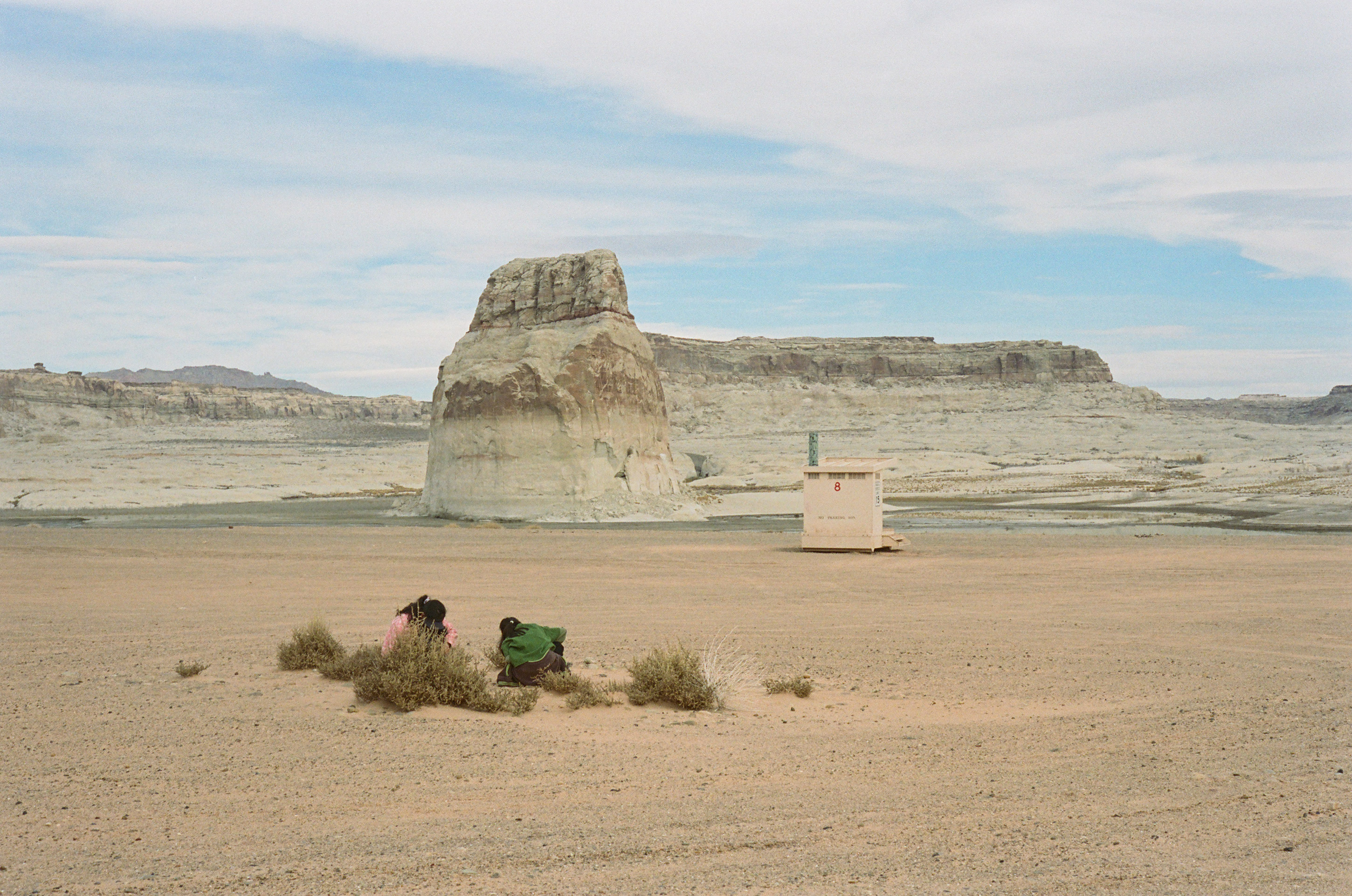
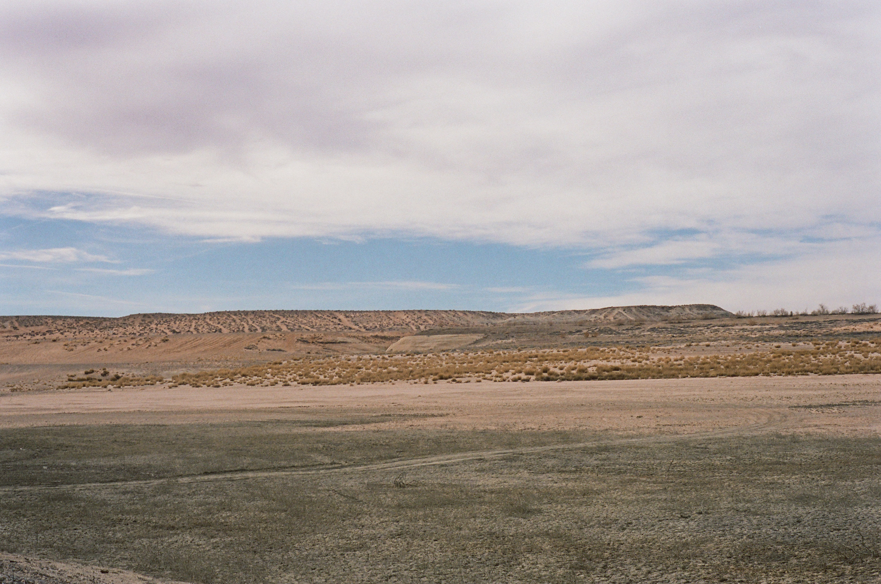
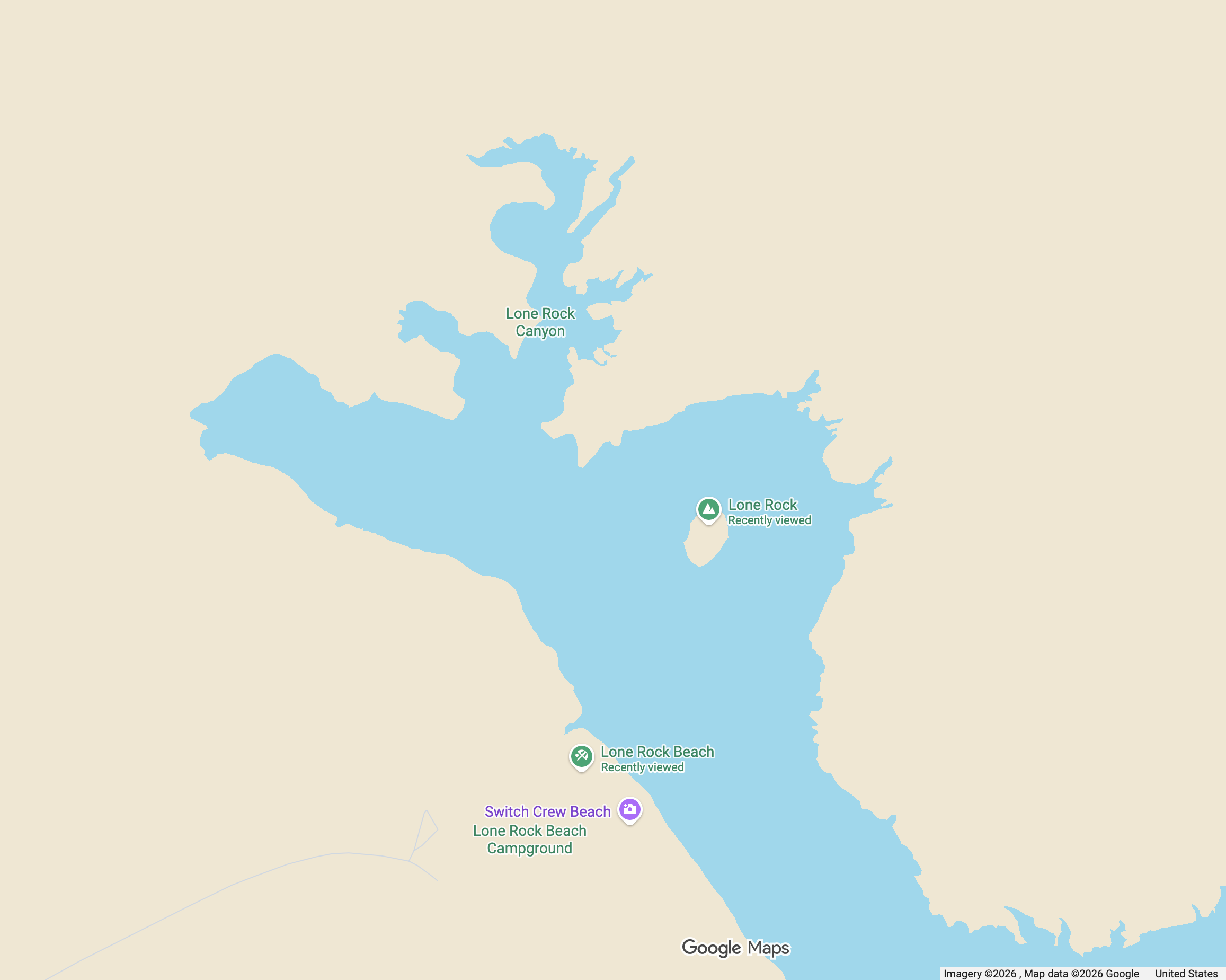
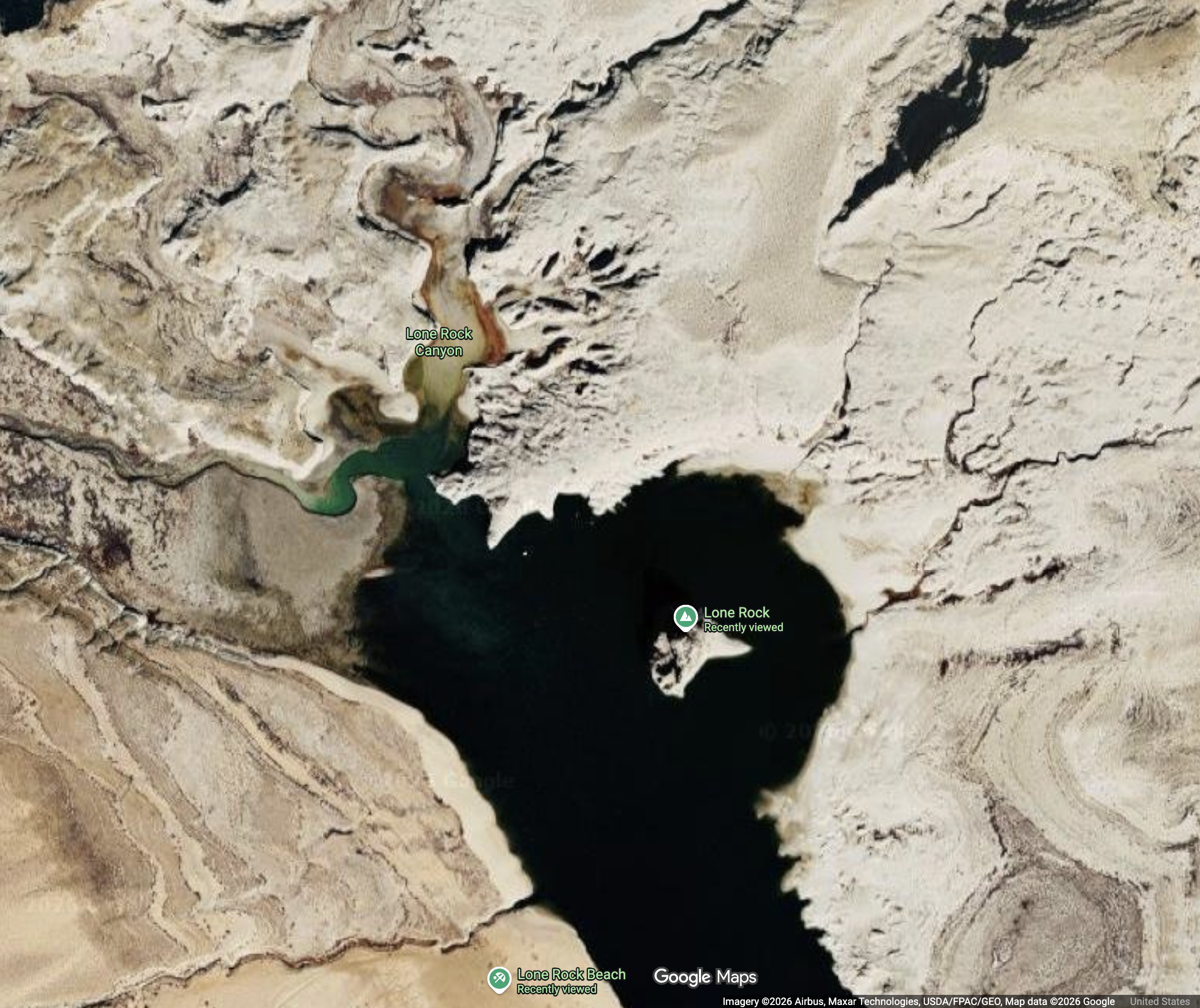
LAST WINTER, I visited Lone Rock, a solitary butte that rises high out of Wahweap Bay, one of Lake Powell’s coves. Decades ago, when the lake was at full pool, Lone Rock was encircled by deep water. But the lake has long since retreated, leaving behind vast plains of sand and a shallow puddle of lake. Even as I walked down the sand flats, towards the rock, I could see that the beach had grown longer and the lake smaller since I had last been to Lone Rock four years before. With the lake shrunk down, Lone Rock seemed taller, its bleached bathtub ring wider. Over a period so short I could not have pointed to any measurable change in the composition of my own body, the contours of the land had been remade, though in this case by shifting water, not shifting earth.
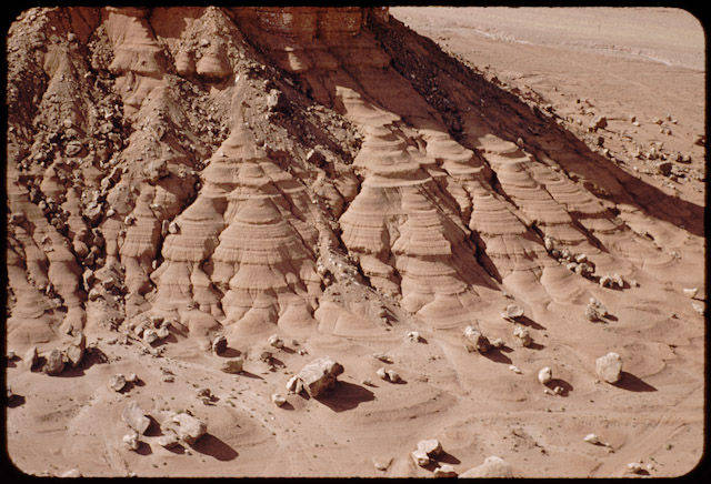
In other places, the earth’s contours are maintained by water, and are remade in its absence. Two days before I went to Lone Rock, I took a walking tour of Antelope Canyon, whose pink swerving walls you might recognize from many a stock computer background. Deep in the canyon, our guide pointed to a rock that bulged out into the shape of George Washington’s profile, and then she pulled out her phone to show the group a photograph of the same place five years earlier.
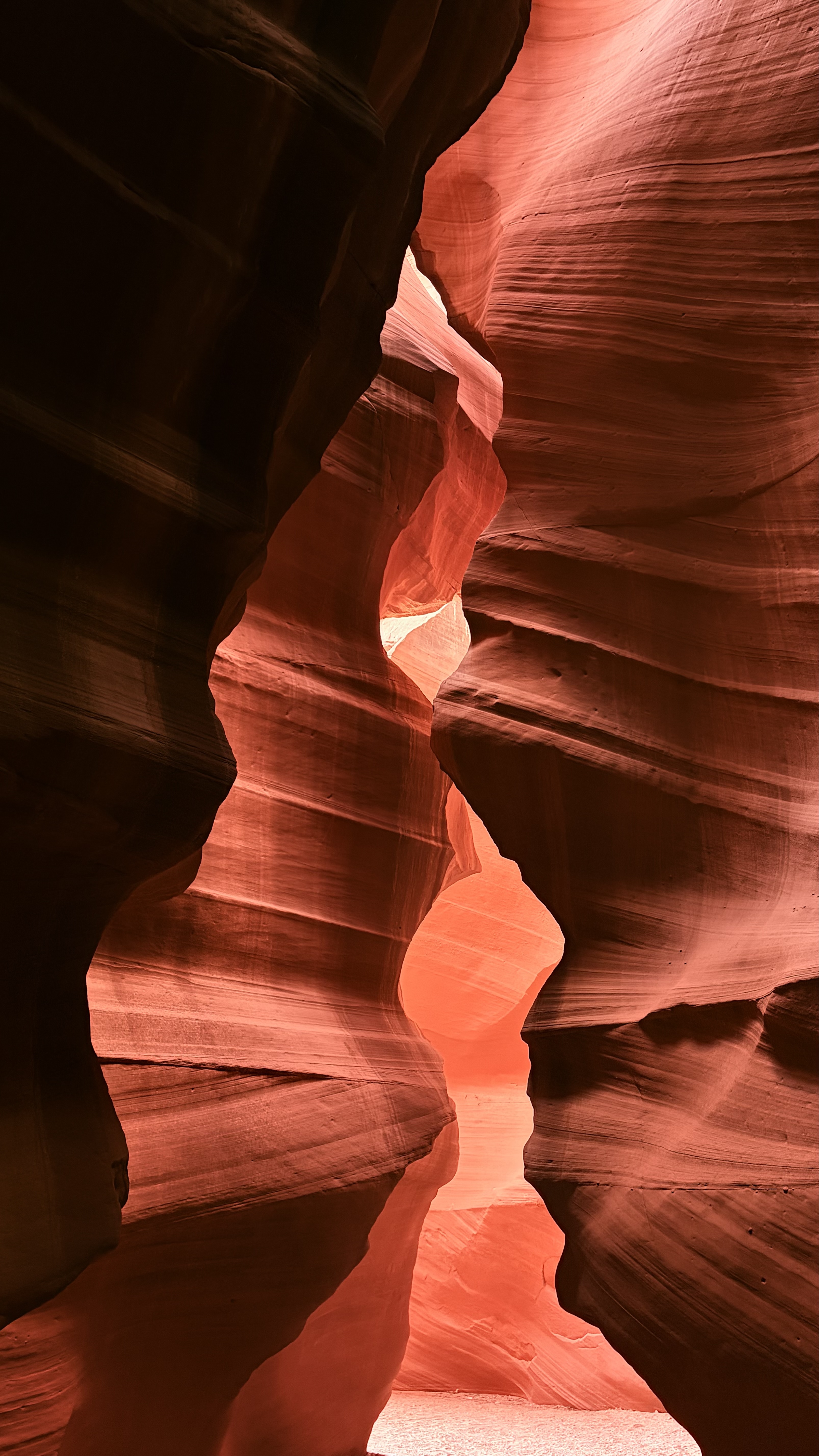
Do you see, she asked us, that the floor is ten feet higher now than it was then? One by one, we looked at her screen, and then back up at George Washington, trying to sync the two different places that were actually the same. Now, we could reach up and touch George Washington’s nose. Then, Washington’s chin had floated high above the canyon floor. Because of the drought, she explained, the spring floods had not come, and so the sand that the wind steadily blows into the canyon over the fall and winter had not been flushed as usual. Instead, sand was filling up the canyon floor. The man next to me looked down at the ground with an air of surprise, perhaps trying to imagine, as I was, how the coordinates of space could have been rearranged so quickly, how a floor could appear where there used to be only air.
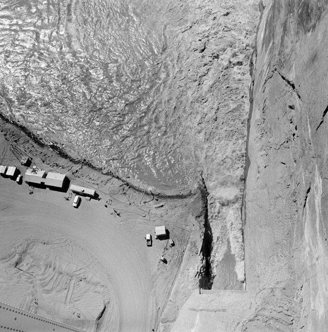
Sometimes, water and earth come together and remake the land into drastic and sudden new forms. In the mere sixty years since the Glen Canyon Dam’s construction, the Colorado River has built towering mud glaciers – some two hundred feet tall – at the point where the flowing river meets the stagnant lake. This point itself is always moving, according to the lake’s level, and the glaciers move with it. Lake Powell’s mud glaciers, which are still new and uncompacted by the forces of time, are loosely bound and prone to collapse. Boaters regularly report witnessing great hunks of mud calving off their banks and slumping into the river. And when these mud bergs fall, they rearrange the river into new channels, and they whip up rapids that shift day by day.
A friend of mine, who runs raft trips on the Grand Canyon in the summers, recently described a similar phenomenon occurring where the Grand Canyon empties into Lake Mead. She said that even the guides who had worked the Canyon for decades did not know anymore what they would find around the Canyon’s final bends. Huge standing waves piling up over underwater mud bergs? A river split into three or four or five narrow channels, or squeezed into one torrential stream? The ground was shifting too rapidly for them to keep up.
On a reddit page (one of my favorites) r/NatureisFuckingLit, I recently came across a video of a strange phenomena at Lake Powell. The video was titled “Underwater Avalanche?!” and subtitled, more scientifically, “Turbidity current at Lake Powell.” In the footage, a cloud of murky, seething water spreads out across the lake’s otherwise placid surface. It looks as if the lake has begun to boil. Suddenly, the cloud darts downstream, trailing a churning path, and I cannot help but think of the way the sandworms in Dune push up ridges of slithering sand before they breach.
Then the cameraman zooms to a dark object slipping fast through the water, and he wonders out loud if it’s an animal trapped in the current – before realizing, with even greater alarm, it’s in fact an entire log being pulled down into the lake. He pans to his boat’s depth gauge, and remarks that the gauge is acting unusually: “it reads almost 150 feet” he says, although “it should be less than 20.” Perhaps, he jokes, he has just seen the Lake Powell monster.
For me and the cameraman alike, the river’s surprising behavior conjures up a supernatural imagination. Only something alive, our instincts both said, could cause the earth to move with such erratic agency. Both of us turned, for a moment, towards the realm of demons, ghosts, and witches to explain what we saw.
It strikes me that there is some irony here. When those of us who have been inculcated by Lyell’s gradualist paradigms encounter a natural event that is not gradual at all, we are left with few ways to process what we are seeing. With no “natural” explanation at hand, we are drawn out into the “supernatural,” which is that bucket where everything unstudied by science, and thus not yet “naturalized” gets thrown. Both I and the cameraman, in other words, have stumbled up against the limits of our own gradualist worldviews. We have witnessed a chasm open within Western logics of nature. What lies beyond those limits and within those chasms is the monstrous imagination. Lyell’s model of a moderate earth, then, does not subsume the supernatural; it produces the shadowlands in which only the supernatural can dwell.
Even as I parse out the flaws with gradualist paradigms, for me, there is something unsettling in recognizing that nature is not so orderly or predictable after all. Perhaps this speaks to how deeply steeped I am in Western views, in the myths that I have spent most of my life consuming about humans reigning in the wilds and vanquishing the monsters that once haunted them. But I cannot help but feel a prickle of squeamish distress when I think about the ground beneath me not as still but as actually in motion, like I’m standing over a pit of squirming, wriggling snakes. And I am even more unsettled knowing that even a highly-managed, manmade lake can suddenly open up and swallow logs whole.
Ghosh groups these feelings of disoriented, unsettled, squeamish distress into the category of uncanniness. The uncanny, he says, emerges in “those moments when something that seems inanimate turns out to be vitally, even dangerously alive.” 9 Recategorizing entities I have previously assumed to be inanimate as “vitally alive” is not always comfortable.
But I do not think that encounters with a more alive earth are always so horror-inducing. When elementary children learn about plate tectonics – or when the man in Antelope Canyon realized he was standing on a moving floor – or when my friend told me about the Grand Canyon generating a new riverscape every day, like some fervent artist, there is also awe, excitement, and captivation.
Perhaps this is why I like to scroll through r/NatureisFuckingLit. It feels good to look through the kaleidoscope of the earth’s expressions and be reminded of the surprising creativity, multiplicity, and vitality of our planet: curtains of rain moving over a city like an army of ghosts; red glittering sand swirling in the ocean’s tides; winds whipping snow into snaking ropes over a frozen lake; baby woodcocks luring worms out of the ground with a tiny, bobbing dance; starling murmurations rippling across the sky. r/NatureisFuckingLit is far from a space of existential horror and distress. By its own description, its 1.2 million subscribers are “here to appreciate the awesome majesty and incredibly cool aspects of nature 🔥.”
This subreddit, seems to me, to signify a collective impulse to witness and catalog an earth that is anything but gradual, predictable, orderly, or containable – to pry open the cracks in the moderate earth and let the monsters, rivers, sand, rains, demons, oceans, snow, and birds flow out into the light.

Sedimentation
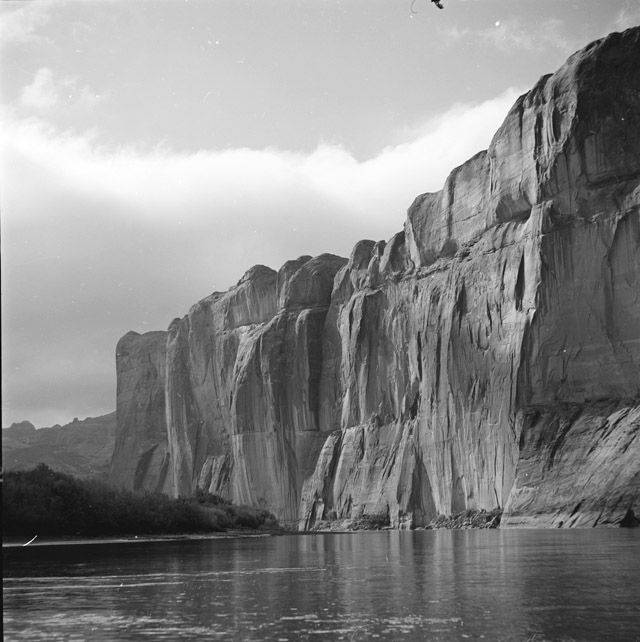
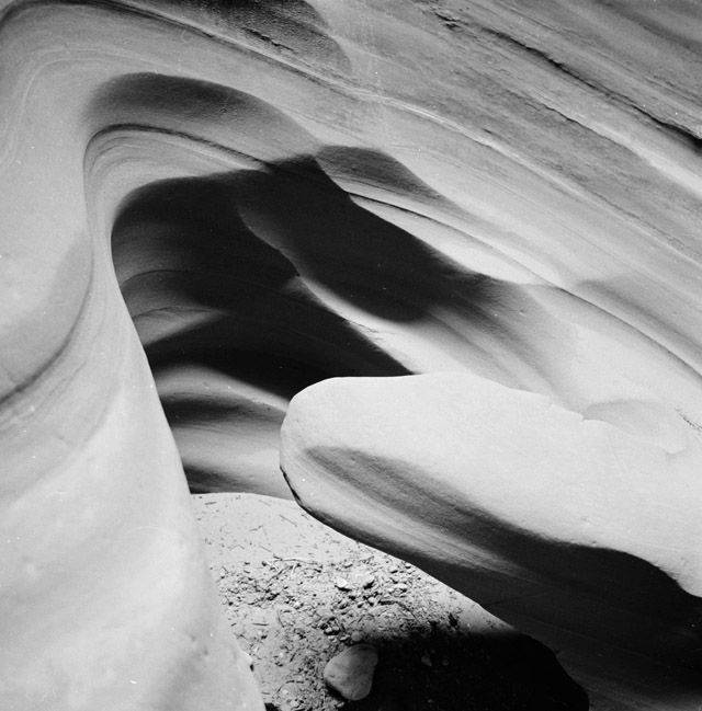
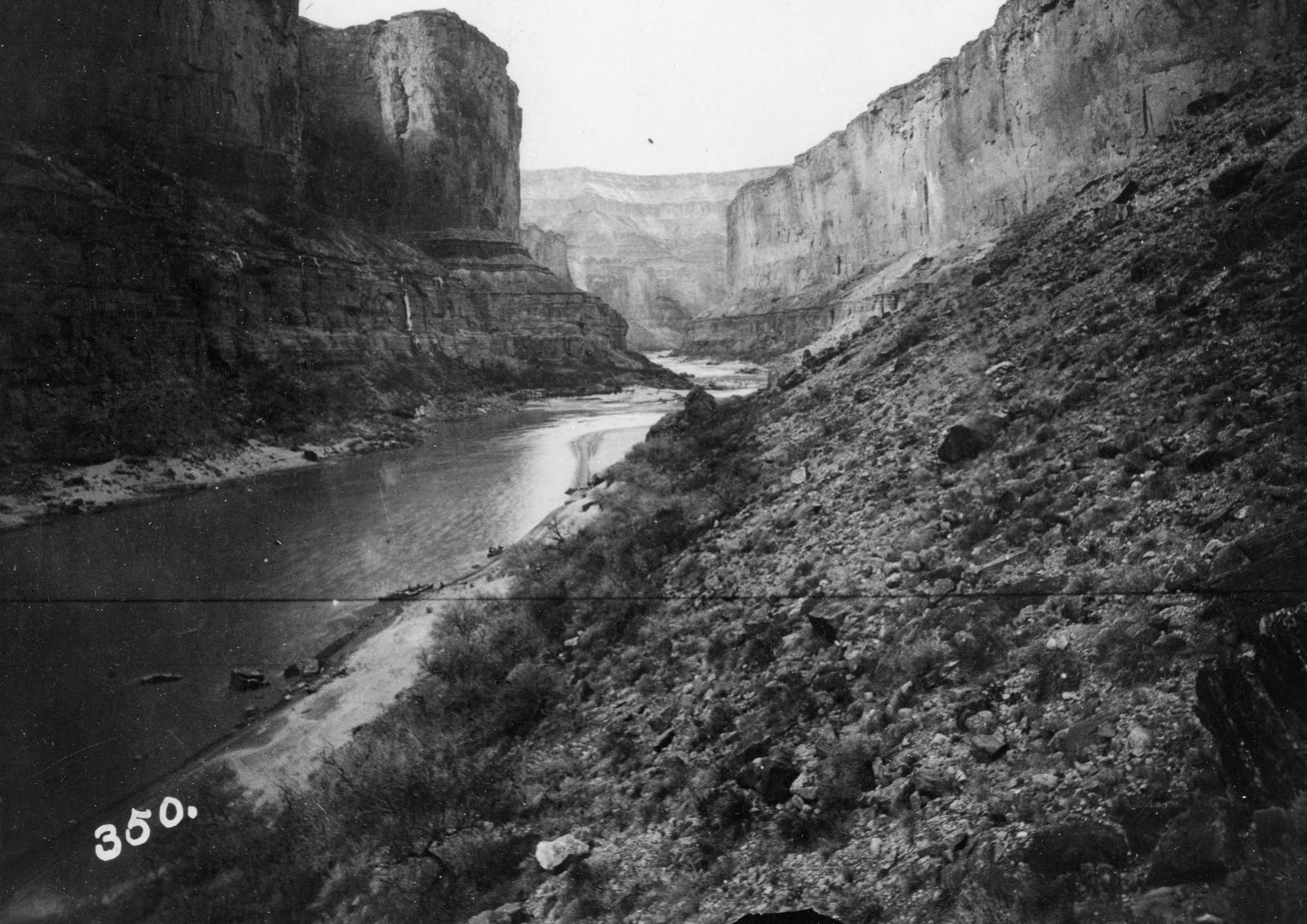
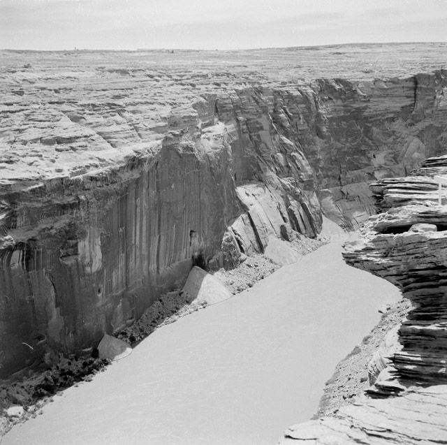
BUT WHAT OF the canyon walls, which do not suddenly warp and twist, but garner so much awe precisely because they seem to have stood exactly in place for millions and billions of years? Many who have visited the canyons of the Colorado River, in fact, are struck not by the land’s motion, but by its remarkable stillness. Author Kevin Fedarko, who in 2015 accomplished the impressive feat of walking through the length of the Grand Canyon, writes of “an absolute dearth of sound or movement.” 10 And Colin Fletcher, who completed the same journey in 1963, spoke of “silence so profound that the whole colossal chaos of rock and space and color seemed to have sunk beneath it and to lie there cut off, timeless.” 11
To descend into the Colorado River’s canyons is to descend into a place where time and space seem to have petrified. If you were to travel to the innermost gorge of the Grand Canyon, where its walls plunge more than a mile below their rims, you would find – could even reach out and touch – the very basement layers of the earth’s rocks. Here, the river has exposed polished black slabs of Vishnu Schist which have held in place for nearly two billion years. This is half the age of the earth itself, and more than a tenth the age of the universe.
Some parts of the earth are riotous with motion, but sometimes the earth is also very, very still.
Lyell and Hutton were not all wrong. Some landscapes do move at a pace so slow, their motions evade the limits of human perception. Of course, most things in the universe are not calibrated to fit conveniently within the bounds of human sensitivities. But since we are only able to register those few phenomena that happen to fall within our narrow frames, we tend to condense the vastly differentiated rhythms of time and space into a kind of moderate uniformity.
The earth, however, can move both extremely fast and extremely slow, and every pace in between. There is no inherent law that dictates uniformity. Rocks can stand still for billions of years, and volcanoes can blow mountain tops off in a moment. This might all seem obvious to say, but it gestures to a fundamental flaw with Lyell and Hutton’s theories: that the earth’s various processes might be explained through one all-encompassing rule, through a geologic theory of everything.
No such homogeneity exists in nature, and it seems to me there is very little chance of understanding much at all through sweeping universalisms. But when reductionist theories gain absolute sway, other truths become eclipsed and obscured.
For instance: geologic strata tell one history of the earth: one of slow, incremental change over immense spans of time. This is a true story, but it is not the only story. By their very nature, geologic formations are sites where movement has been compressed out, where things have become cemented in place. Objects in flux cannot be captured in this format, and so the geologic record is only a catalog of things that have stopped moving.
What does not make it in to this record are the bits of the earth still in motion: the rock flecks that fly around on the wind, the bone dust sifting through the world’s rivers and oceans, and the literal quintillians of animals, plants, and humans still moving on their own volitions, whose flesh will likely never be preserved in the geologic archive.
And so when strata become the axiom of historical knowledge, the undisputed record of the past, the world in motion is left out. This is an omission of extreme proportions, not only because so much of the world’s stuff is not ossified in stone, but because the world we really live in is precisely one of constant movement, in which nothing ever stands perfectly still.
A history without motion renders space and time down to a series of “static time-slices,” as if reality is drawn up like a cartoon in which the characters are not actually moving, but the illusion of movement is created by stringing together a series of still frames. However, as geographer Doreen Massey reminds us, movement “cannot be broken up into discrete instants,” and imagining history as a sequence of stacked layers fails to “bring alive the trajectories” which in fact “co-form” space. 12 “Static time-slices” Massey emphasizes, “even multiplied to infinity, cannot produce becoming.” 13 Here, Massey is speaking of the specific kind of time-slices represented by maps, but it seems to me her reasoning might be readily applied to geologic strata, which are also types of static time-slices, and which however deep or finely layered, cannot produce becoming either.
There is another problem in trying to understand the world without motion. When things are in motion, they come into contact with one another, or tear apart, and thus create a sprawling and constantly shifting network of connections and disconnections. In Massey’s eyes, it is this network of interrelations that creates space itself, which she argues is not separate from time at all. Space, for Massey, is movement, or in her own words, it is “a simultaneity of stories-so-far.” 14
There is a political edge as to whether we represent space as a fixed and layered plane or as a rhizome of criss-crossing trajectories. For Massey, “the notion of a section in which all elements exist in immediate relationship with one another is essentially a description of a closed system,” which in turn “robs it of all political potential.” 15 Imagining space as fixed, in other words, shutters the possibility for new relationships to form, and therefore shutters the possibility for social arrangements to be reformulated into new political structures.
Stabilizing space not only forecloses certain futures, but also erases certain pasts. Massey argues that practices which lay out space on fixed surfaces, such as mapping, make relational trajectories invisible.” It is thus, she concludes, “that others are rendered static, without history,” and space becomes a “blank page” to be explored. 16
Like Massey, I am interested in pressing against forms of representation that distill space into static layers and exclude motion, or that take the wide view while ignoring the particular. While Massey is most concerned with the stabilizing power of maps, I am concerned with the stabilizing power of strata, and I am wary of thinking that enlists strata as the primary archive of the earth’s history.
I want to be careful not to construct my own theory of everything here. I want to accommodate both motion and immotion; I want to include the blowing rock flecks, the flowing bone dust, the running, creeping, swimming life, and I want to include the very still and very old canyon walls. I want a way of thinking about the earth, about space, about time, that allows for difference and multiplicity. I want to let the rocks stay in place for billions of years, even if – or perhaps especially because – my decades-old self cannot understand this kind of stillness. I am glad to know that not everything moves in such a hurry. But I also want to stay alert to the different kinds of movement happening around me, the relationships always forming and deforming, and remember that each thing, each atom of each thing, carries its own past and future of growth, decay, connection, disconnection, and rearrangement – even if I will never be able to trace out a complete map of these trajectories. It is enough to know I am surrounded by this kind of vibrancy, and I sense that all I can do is sketch out the faint and half-formed outlines of this world in process.
Perhaps you can see where this is going: I am gesturing towards a sedimentary model of time and space. Sediment, I have found, is good for thinking about multiplicity, about difference, about stillness, movement, relations, contingencies, particularities, and loose ends. I am not speaking metaphorically; I am arguing for an inquiry of place that literally follows alongside the movements, accumulations, dispersals, and transformations of sediment. Sediment shows me where the earth holds still, where it is in upheaval, where things come to meet or break apart, and it reminds me that none of this is ever finished. I am advocating for a sedimentary archive.
Muddied Maps
THE SECOND TIME I visited Lake Powell, I arrived in the dark. My then partner and I were on our way back from a trip to Marble Canyon, where Glen Canyon officially (and somewhat arbitrarily) becomes the Grand Canyon. We camped on a ledge overlooking the Colorado River and for four days watched condors drop into the canyon’s shadows and then climb back out into the sun.
We left Marble Canyon when the sun was setting, and by the time we got up to the lake it was night. We wound our way around the outstretched arm of Wahweap Bay, and when we reached its furthest edge, we turned onto a small road that promised to take us a camping spot I had pinned on my phone map. But when we came to the pin there was nothing; nowhere to exit the road, no signs, no obvious place to camp, nothing. We thought the pin was off place, and so we kept going – but then the pavement abruptly ended, and we were driving over loosely-packed sand. In the dim arc of the headlights, the sand came into view and slipped under our car without seeming to change at all.
I began to feel as if we were not really moving, but were trapped on an endless belt that was spinning beneath us while we remained exactly in place. It became difficult to keep track of where we had come from, how far we had gone, and how we might find our way back to the road.
I checked my phone, but our little blue dot was now bobbing across the lake. My phone isn’t loading properly, I thought, and so we kept driving until the car’s tires began to struggle in the soft ground, and we called it a night and went to sleep right there.
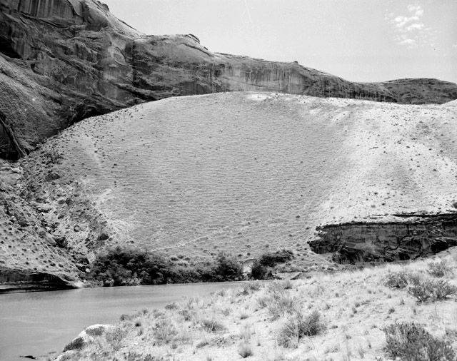
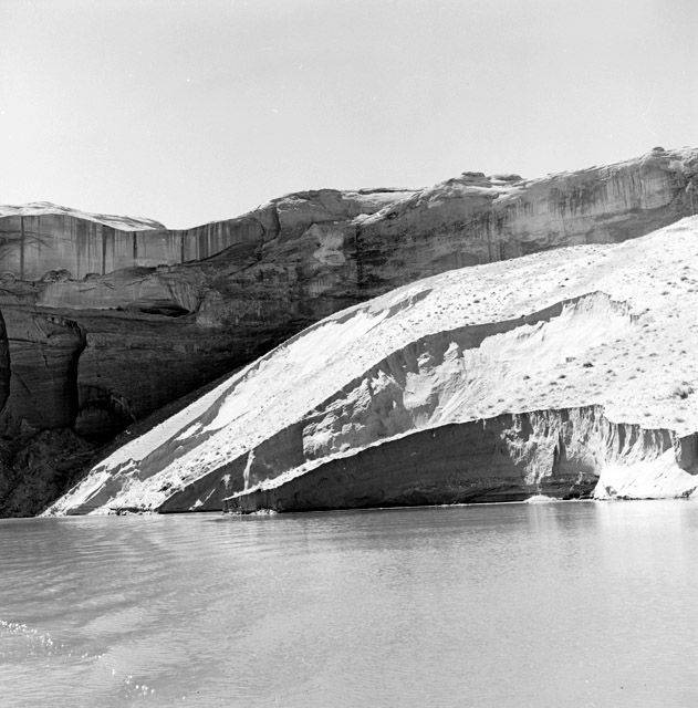
In the morning, we woke up to a strange landscape. A basin of crackled sand rose up around us, which at its center held a haystack rock circled with water. The rock was oddly colored; red up top but then suddenly white, as if someone had filled and drained a bathtub, leaving behind film of soapy grime. There were sparse camps in the distance, and we could see people walking or riding motorbikes over the mottled beach. The ground seemed too unstable for motorbikes, I thought; it was riddled with cracks and turned spongy towards the water. It was then that I realized we were camping on the bottom of Lake Powell.
When I think now about where my fascination with Lake Powell and Glen Canyon began, I come back to this moment, and the discordance I felt in my body as I tried to imagine what it would have been like to stand in this same spot just a few decades earlier. I would have been looking up from the dark bottom of the lake; catfish swimming at my ankles, pondweed tangling thickly around me, coots diving down from the surface, boat hulls gliding darkly above. But there was also the jolt of realizing that space as I had imagined it – as I had seen it on my map – did not line up with space as it really existed.
I grew up in the age of Google Earth, and I cannot remember a time before I could readily look at the contours of the entire world from a satellite view. I can zoom to a desert on the other side of the continent, and locate the road that will take me through it, the blue ribbons of its streams, and the blurred green tree tops where I might find shade. I do not have to go to that desert to know these roads, streams, and trees exist; I believe they exist because their outlines have been captured in a photograph and stitched together on my map.
My imagination of space has become almost exactly synced up with satellite maps; the pixels arranged into roads and streams and trees were, I assumed, generally placed along the contours of actual roads and streams and trees. The map came to stand in as a window into real space. But now the pictures did not line up: the map had misplaced the edges of an entire lake, by more than a few pixels.
Of course, no map, no static time-slice can account for every instantaneous shift in space or each of its details. The pixels are not always up to date, nor are they rendered at a fine enough scale to capture, for example, whether the road has been torn apart by potholes, whether there are fish moving through the stream,or whether the trees are low and scrubby or tall and canopied – all of which matter for the experience of being in that place.
But I recently went back to the map of Wahweap Bay, and toggled between its satellite layer and its illustrated layer, and I realized that the map’s misconstruals were about more than data resolution. The two pictures do not line up. The illustrated layer shows water even where the satellite version attests there is none – not anymore. But by labelling the two maps as “layers,” the map asserts that its drawn pixels are simply transposed over a live data stream, a faithful replica, of actual space. The map asserts it is a window when it is in fact a vector of abstraction, an imagination.
Maps have always been this way – an imagined abstraction of real space. “Every map,” writes cartographer Denis Wood, “shows this but not that.” 17 To include everything in the map is representationally impossible; a map of everything would have to be an exact replica of the earth itself. But Wood emphasizes that despite their often obvious abstractions and exclusions, by building up their own sign systems, maps become “naturalized” representations of space; maps stand in for the world “as it really [is].” But Wood reminds us that “no sooner is the sign created than it is put to the service of a myth.” Maps are not windows, they are interfaces used to make “statements about the world,” to construct meaning, to write narratives. 18
There is lot we might learn, I think, in paying attention to the misalignments, the gaps, the fissures between constructed maps and experienced space – about the myths we have come to believe, and where those myths fall apart.
Standing in Wahweap Bay, at the bottom of Lake Powell, I found myself caught in one such gap. That was the discordance I felt – the tearing of constituted meaning from reality. And it was that discordance, which stayed with me for years after, that sent me seeking to understand how and why the real and represented had become so dislocated from one another – that sent me looking for what pours out from the fissures.
Now, I can trace a line between the myths generated by those maps and the myths that Charles Lyell propagated in the early days of geologic science. Both insist on space as a time-slice, on land as a stable surface atop which humans may lay their lives. This myth of a stable earth fixes its elements in place – robs them of history, renders them objects, and thus readies them to be explored, extracted, and conquered. And now I can see too, where the loose and muddy earth resists and interrupts such myths.

Stanton’s Dredge
ROBERT BREWSTER STANTON was working as railroad surveyor when he read of John Wesley Powell’s trip down the Colorado River. Powell’s tales of adventure through the river’s tortuous rapids and labyrinthine canyons lit up Stanton’s imagination, and he concocted a dream for himself: one day, he would build a railroad across the Grand Canyon.
But neither Stanton nor anyone else would go on to accomplish such a feat. The Grand Canyon is not the narrow chasm Stanton had dreamed of; it stretches anywhere from four to eighteen miles from rim to rim.
Nevertheless, fueled by his ambitions, Stanton pursued a career in railroad engineering, and eventually, he did make it to the Colorado River – not to build a railroad across it, but to lay one alongside its shores. It was a promising scheme: at the time, coal was pouring out of Colorado and was desperately needed in California, where great cities were beginning to spring up and grow. A water-level railroad, Stanton thought, could transport coal from one place to another without having to blast through the colossal mountains that riddled the West.
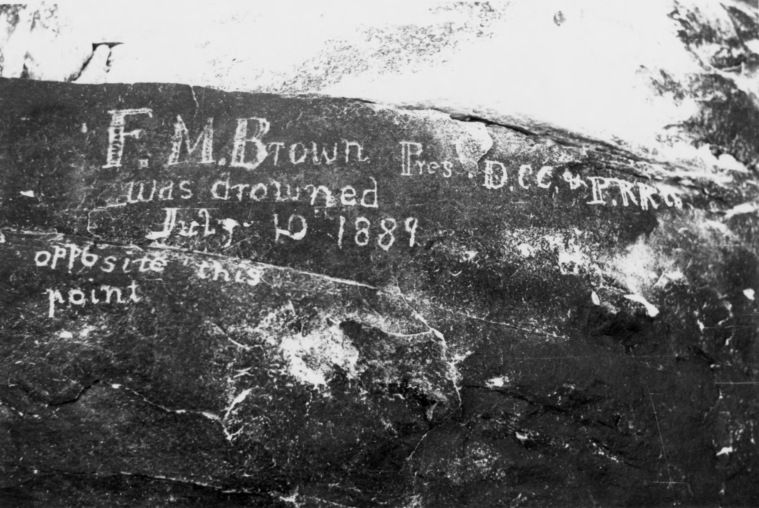
Before construction could begin, however, the river first needed to be surveyed, its topography mapped and plotted. So in 1889, braced with a flotilla of boats, men, and equipment, Stanton pushed off from the banks of the Green River – just as Powell had done exactly thirty years earlier.
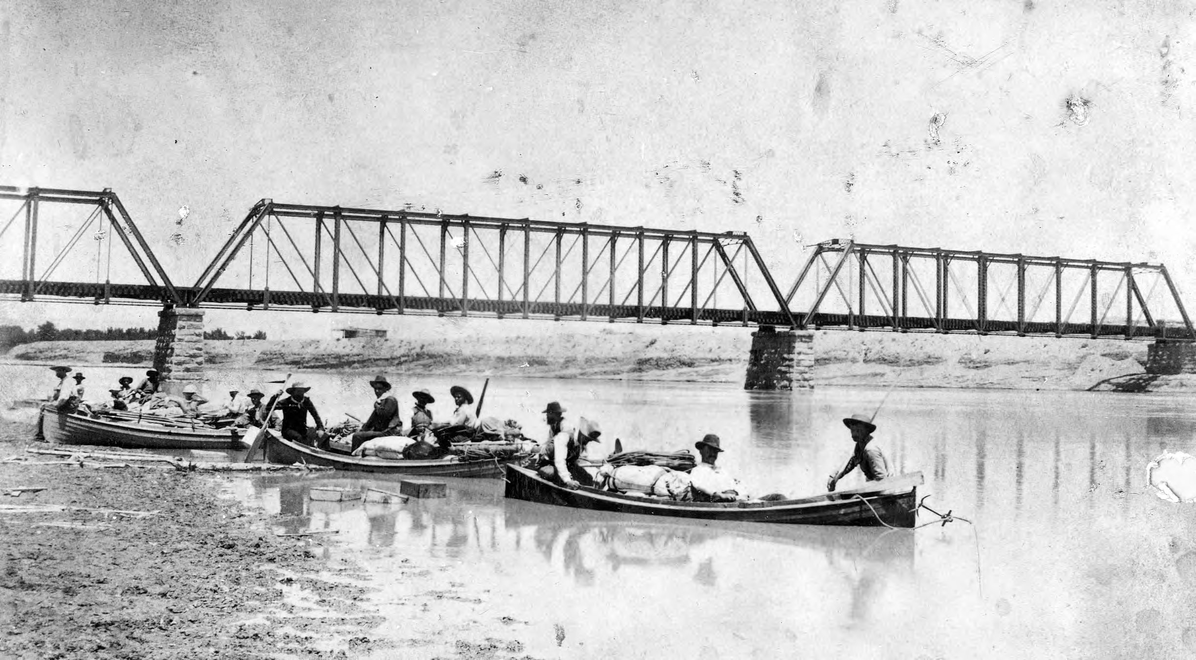
From the very start, though, things fell apart – including Stanton’s boats. His business partner, Franklin Mason Brown (President of the Pacific Railroad Company), had ordered the dories to be constructed not with durable oak, as Powell’s had been, but with thin planks of cedar which Stanton said “split at every contact.” Brown also dismissed the four experienced boatmen Stanton had hired and instead brought on his friends, who had no experience with boating whatsoever, but were “charming and genial young lawyers and clubmen of Denver.” In fact, Brown claimed, these lawyers and clubmen were so “healthy and athletic” they had no need for any kind of “unmanly aid,” and so he refused to bring aboard life jackets for his crew. Although, to his credit, he made an exception for Stanton, who had a disabled arm and “could not swim a stroke.” 19
The expedition proceeded smoothly through the placid waters of Labyrinth and Stillwater canyons. But things unravelled the moment the group entered Cataract Canyon. Just above the canyon’s first rapid, for reasons that were inexplicable to everyone, Brown ordered the men to move their camp from the flat, long beaches of Spanish Bottom to the other side of the river because Brown wanted to sleep in the rocks. The crew protested; the current was extremely strong and the rapid just below them viscous, but Brown overruled. As soon as the men rowed out into the river, two of the boats were sucked into the churn and lost, along with the majority of their provisions.
All the men – except Brown – were put on tight rations; just a cake of bread “without baking powder or salt, one can of condensed coffee, and a handful of beans” per day. 20 Fearing mutiny, Stanton eventually intervened and put Brown on a rationed diet too. But for some of the crew, it was too little too late. By the time the expedition reached Lee’s Ferry, the last place to exit the river before entering the Grand Canyon, four men quit the outfit and left.
Brown and Stanton, however, decided to press on with their remaining crew, and turned their boats into the mouth of the Grand Canyon.
The group portaged successfully around the Canyon’s first rapid, but Brown’s boat was quickly overturned in the second. Brown was thrown into the water, and after giving a hearty wave to his crewmate onshore, he disappeared beneath the torrent and was never seen again. Stanton concluded that the “silt-laden water had filled his clothes and dragged him down.” The men agreed that if he had been wearing a life jacket, he would have survived. 21
Brown’s death, unfortunately, only marked the beginning of the expedition’s worst trials. At this point, the men had ventured a mere eleven miles into the Grand Canyon, and there was much further to go. It did not take long for tragedy to strike again; three days after losing Brown, at 25-mile rapid, two more men drowned after their boat capsized in a strong eddy. Stanton wrote in his journal that he was “crushed,” and also that his crew was now too small to finish the expedition. He called off the trip and vowed to return the following year. 22
Just six months later, Stanton was back, with new men, new boats, and a better idea of what he was in for. His preparation and experience paid off; all of the men made it through Stanton’s second trip alive, though not without ordeal. Crew member Franklin Nims broke his leg when he stepped backwards off a cliff while taking a photograph and had to be evacuated – an ordeal that involved first fixing him to a homemade stretcher of lashed oars, and then hauling him up the canyon walls with ropes, or otherwise shoving him under rocky holes, all in the middle of a snow storm. Later on, one of the boats, the Sweet Marie, exploded into splinters after crashing into a rock, at which point McDonald, who had witnessed Brown’s drowning the year prior, quit and climbed out of the Grand Canyon alone. When the expedition reached the Canyon’s end and came upon a woman’s footprint in the sand, one of the men dropped to his knees and kissed the ground.
At last, Stanton was ready to build his railroad. Armed with photographs, maps, and blueprints, he traveled to Washington D.C. to finalize plans with his investors. By the time he got there, though, the temperature on coal had gone cold; oil had recently been discovered in Southern California, and there was no longer a need to ship coal from Colorado when Californians had found something even better. After all his efforts, tragedies, and tribulations, Stanton’s railroad dreams died in an instant.
But Stanton was not yet defeated, nor was he through with the Colorado River. In fact, Stanton believed that he too had discovered something much greater than coal or railroads. While camping on the shores of Glen Canyon, Stanton had noticed flecks of flour gold glinting in the sand.
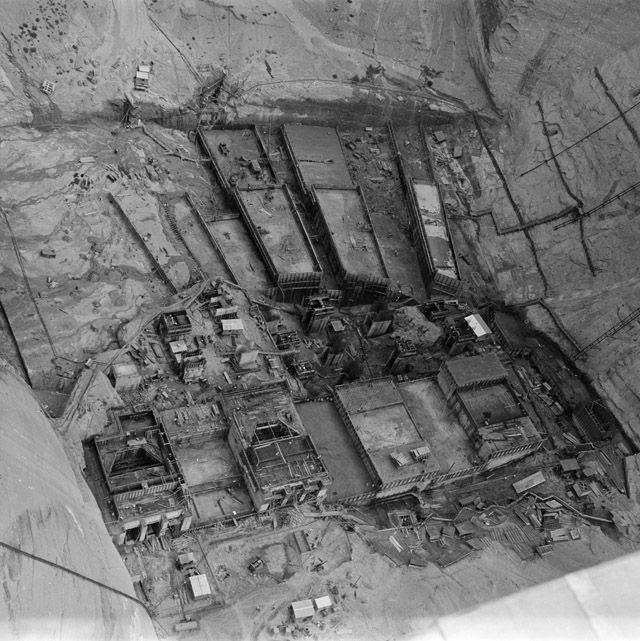
Stanton returned to the Colorado once again, this time as a gold miner, and staked out nearly the entire length of Glen Canyon under 145 claims. By 1899, Stanton had set to work transforming the canyon into a bustling mining outpost; he hired crews to blast roads, build cabins, put up a blacksmith shop, and even construct an ice plant.
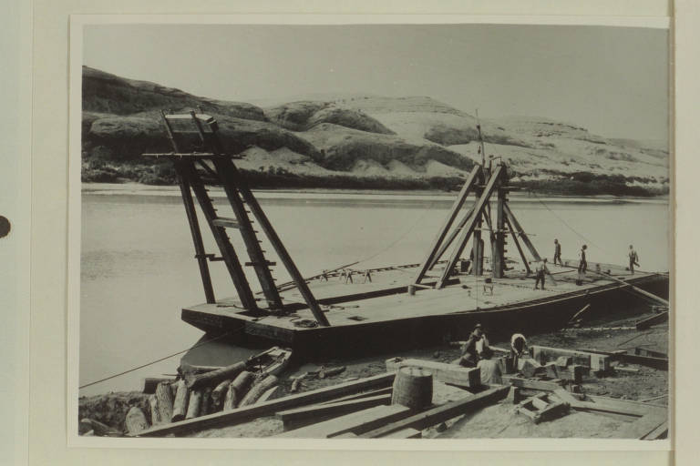
Most importantly, Stanton needed a way to sift gold dust from silt, and he ordered a 150-ton dredge machine to be shipped and delivered from Wisconsin. This turned out to be a ludicrously difficult endeavor. First, the dredge had to be disassembled, packed onto freight cars and sent to Green River, Utah. From there, the machine was loaded into wagons led by twenty-horse teams, which pulled it as far as Hanksville. A road had not yet been constructed from Hanksville to Glen Canyon – so Stanton built one, and the horses and their wagons and the dredge stumbled 100 miles down the rough-cut trail to the Canyon’s edge.
At the river, the dredge parts were transferred onto boats that carried them upriver to the mining site. The boats, though, were so burdened by the heavy machine that they often had to be pulled along by a mechanical windlass. Finally, the dredge arrived to Stanton’s camp, where fifteen carpenters and engineers were waiting to reassemble the dredge and erect a two-story housing over the top of it. The entire ordeal cost Stanton $100,000 (about $4 million in today’s dollars), but by March of 1901, the operation was at last ready to begin.
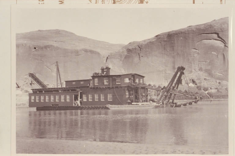
The dredge began drawing up buckets of silt from the river bottom, and workers began sorting out the gold bits by running the slurry over tables coated with mercury. The gold was separated from the sand, and the sand was flushed back out into the water.
But once again, from the very start, things went off the rails for Stanton. The river level changed day by day, as it was apt to do, and when the water got too low, the dredge dropped into the river’s soft bed and became stuck. The machine was incredibly difficult to dig out, and almost as soon as it was freed, the river would drop it all down again.
Even with the dredge working, the operation recovered little gold. The river and its sharp sand had chewed the gold bits into dust so fine that when the gold released from the mercury amalgam, it floated right to the top of the solution and back out into the river, along with the rest of the tailings.
After two months of running, Stanton tallied the value of his stock: $66.95. By September, Stanton was summoned to New York to meet with his investors, who forced him to sell the company. They found a buyer quickly: a J.T. Raleigh in Salt Lake City who bought the entire enterprise, including the claims, dredge, building, and equipment for $200.
The dredge never ran again. Over the next decades, the dredge was slowly picked over by other hopeful miners, who pried away its timber to build cabins and fires and tore off its metal parts, perhaps to repair their own machinery. By 1938, all that remained of Stanton’s dredge was a half-submerged skeleton of twisted metal, slowly coming apart in the river.
Like so many other settlers drawn hopefully to the West, towards its promises of fame, wealth, and self-determination, Stanton learned the hard way – learned over and over again, in fact – that the land does not always sit idly by to be plundered and conquered, no matter how much it is explored, mapped, and blasted. For all his efforts, Stanton could not lay railroads nor his dredge cleanly on the surface of a still earth, but instead ended up bogged down in its muddy flows.

The Dominy Formation
AS SETTLERS PUSHED out across the American West, they met a mercurial and often meddlesome landscape. The Colorado River, in particular, seemed to many expansionists a kind of wild beast that must be tamed before civilization could begin.
The river’s whims had made settlement difficult in the basin from the beginning; water was either catastrophically scarce or came in great deluges that wiped houses off their banks and tore crops from their fields. Settlers fought back the river as best they could, but they were mostly left to their own devices, and received little assistance from the federal government – that is, until the flood of the Salton Sink.
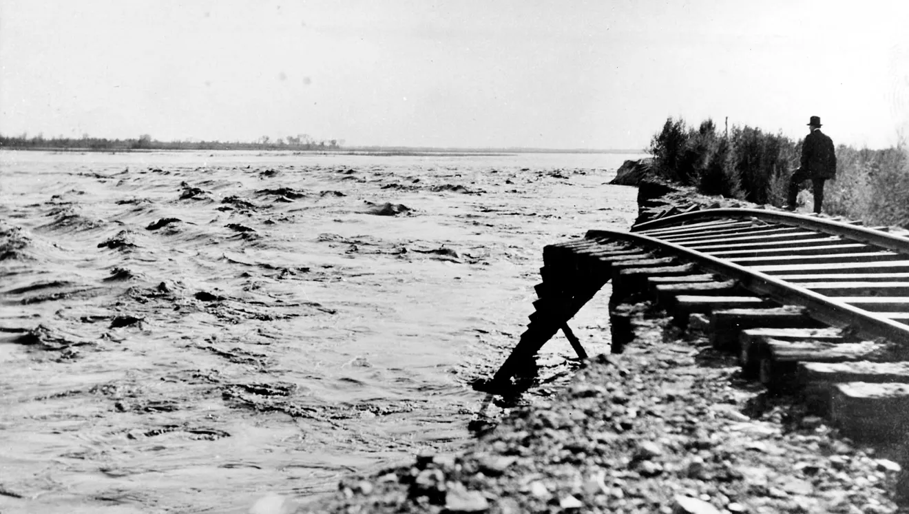
During the spring runoff of 1905, the Colorado River ate through a newly-constructed diversion canal, and for the next two years, emptied itself completely into the Salton Sink, a low-lying basin near California’s Imperial Valley. In 1907, after the river had spread an inland sea over 100,000 acres of farmland, railroad lines, and villages, President Roosevelt ordered engineers to find a way for the Colorado River to be “put back in its natural bed.” 23
By 1946, the Bureau of Reclamation had come up with a plan to subdue the Colorado River, which they laid out in their report titled “A Natural Menace Becomes a National Resource.” The report opens with a kind of mythical vision of the river’s past, present and future (abbreviated here):
Yesterday the Colorado River was a natural menace. Unharnessed it tore through deserts, flooded fields, and ravaged villages. Man was on the defensive. He sat helplessly by to watch the Colorado waste itself or attempted in vain to halt its destruction.
Today this mighty river is recognized as a National resource. It is a life-giver, and power producer, a great constructive force. Although only partly harnessed by Boulder Dam and other ingenious structures, the Colorado River is doing a gigantic job. Its water is providing opportunities for many new homes and for the growing of crops that help to feed this Nation and the world. Its power is lighting homes and cities and turning the wheels of industry. Its destructive floods are being reduced. Its muddy waters are being cleared for irrigation and other uses.
Tomorrow the Colorado River will be utilized to the very drop.
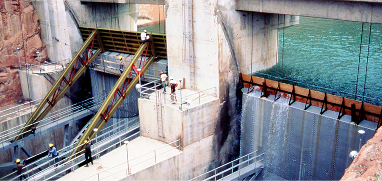
In the ensuing 392 pages, the Bureau goes on to specify their blueprint for accomplishing this vision: they would construct more than one hundred dams along the Colorado River – one of which was to become the Glen Canyon Dam. 24
For about twenty years after the Glen Canyon Dam’s completion, it seemed the Bureau had accomplished their mission. The Colorado River now emptied into Lake Powell instead of tearing wildly across the land. In a promotional booklet published two years after the dam’s completion, the Bureau’s then-commissioner Floyd Dominy wrote triumphantly that “Man has flung down a giant barrier directly in the path of the turbulent Colorado. It has tamed the wild river – made it a servant to man’s will.” Dominy goes on, praising the dam’s “graceful bulk” and boasting about its first-place award in a national engineering competition. He asserts that “the manmade rock of the dam has become as one with the living rock of the canyon,” and finishes with a solemn declaration that the dam “will endure as long as time endures.” 25
But in 1983, when a record-breaking snow year met a rapidly-warming spring, the river reared its wild head once again. Lake Powell filled with such speed that the Bureau could not release enough water to keep up with the heavy inflows, and as the water climbed higher, the Bureau scrambled to prevent the lake from overtopping the dam. In desperation, engineers nailed marine-grade plywood to the dam’s spillway rims, and miraculously, it worked: although the lake rose eight feet over its maximum capacity, the plywood held and the dam remained standing. But the near-miss riddled cracks through the twenty-year illusion that the Glen Canyon Dam had finally bent the Colorado River into submission.
Today, the Glen Canyon Dam is facing a different kind of crisis: as of March 2026, Lake Powell sits just 38 feet above the minimum level required to continue operating the dam. 26 The lake has fallen almost exactly that amount over the last year, and due to a low-snow year, inflows for 2026 are expected to be about half the river’s average. 27 If and when the lake drops below minimum pool, the Grand Canyon will see only a trickle of its previous flows, and water supply for the 27 million people downstream will be severely curtailed. All at once, land and life in the Southwest could be direly transformed. In a stroke of grim irony, the Bureau’s efforts to quell the river’s volatility have instead produced an infinitely more volatile landscape.
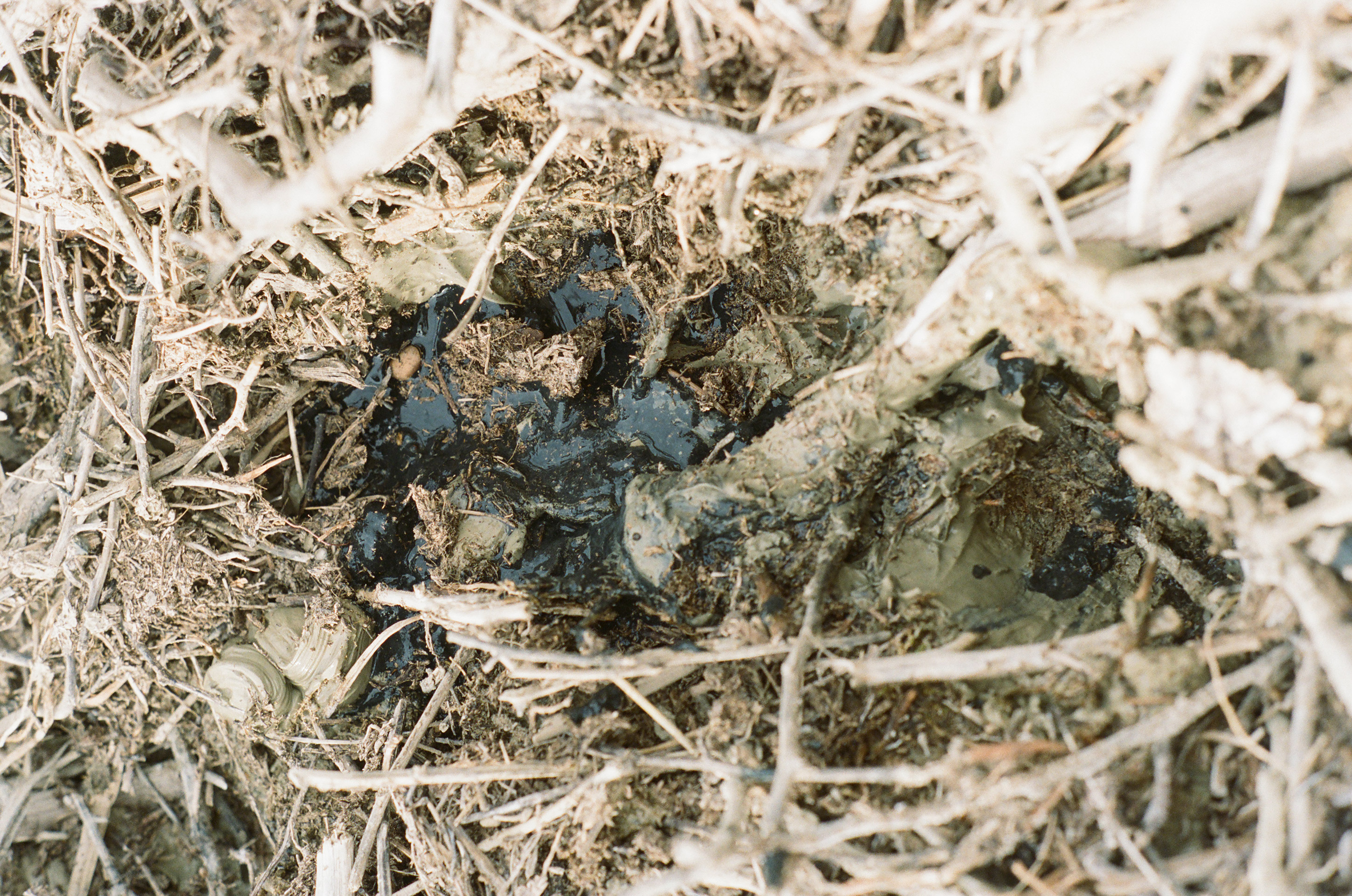
Yet another threat looms over the Glen Canyon Dam. Since the dam’s construction, the river’s heavy sediment load has been heaping up into glaciers that, in some places, tower almost 200 feet above the lake. As the water wends its way through the mud, always bringing more sediment, the glaciers drift and deteriorate and rise up again, like a writhing slug.
Thus, a new geologic formation – dubbed “the Dominy Formation” by researchers after the man who built the dam - has sprung up in Glen Canyon. 28 It did not arrive gradually, over the long pulls of deep time; here, the earth moves in step with human life.
For now, the Dominy Formation sits far above the dam, in the upper reaches of the lake. But as water levels plummet, the formation is shifting downstream, creeping every year closer to the dam. The dam was built to hold back water, not mud, and scientists have warned that when and if this mud collides with the dam, there is no telling whether the dam will hold. Even if it does, sediment will continue pouring into Glen Canyon, as it always has, but with nowhere to go, the canyon will eventually – by some estimates, in as little as fifty years – fill completely with sediment. Then, as Donald Worster predicted in 2000, the Glen Canyon Dam will “become a manmade waterfall and its reservoir a vast plain of alluvial mud drying in the sun.” 29
The Glen Canyon Dam will thus endure only as long as it takes for the Dominy Formation to move downstream.
Bypass
THIRTY FOUR YEARS after the completion of the Glen Canyon Dam, at a restaurant in Boyce, Virginia, Floyd Dominy pulled over a cocktail napkin and began sketching out his dam. Sitting across from him was Richard Ingebresten, founder of the Glen Canyon Institute, a nonprofit dedicated to restoring a free-flowing Colorado River.
This was an unlikely meeting: one man had spent his career building the dam, the other advocating for it to be decommissioned. But Dominy had agreed to give David Brower -— perhaps the dam’s most famous opponent – bookends made from core sample drillings taken during the dam’s construction, and Ingebreston was there to collect them.
When Ingebreston arrived, however, Dominy changed his mind. He wanted to keep the bookends, but he allowed Ingebreston to take a picture. Dominy set the bookends on his desk, and placed the promotional brochure he had written between them, the same brochure in which he had asserted that the Colorado River had been made a servant to man’s will. As Ingebreston raised his camera, Dominy stood behind the brochure and drillings, laughing. Then the men went to dinner.
Surely Dominy had drawn out the Glen Canyon Dam a hundred times before – he was its chief architect. With hasty strokes, he put down the curving canyon walls and the thick arc of concrete. He scribbled in the spillways and the old bypass tunnels, which had been used to divert the river when the dam foundation was first laid. But then he added two new lines. “I’ve been thinking about it,” he told Ingebresten, “All you have to do is drill new bypass tunnels around the old ones in the sandstone.” Ingebresten was stunned; Dominy had just outlined a plan for draining Lake Powell and decommissioning the dam he had once declared eternal. “This has never been done before,” Dominy said. “But it will work.” 30
Works Cited
-
Ghosh, Amitav. The Great Derangement. University of Chicago Press, 2016, p. 27. https://press.uchicago.edu/ucp/books/book/chicago/G/bo22265507.html ↩
-
Lyell, Charles. Principles of Geology. 4th ed., vol. 1, John Murray, Alebemarle Street, 1834, p. 109. ↩
-
Ghosh, p. 26 ↩
-
Ghosh, p. 29 ↩
-
Kimmerer, Robin Wall. “Learning the Grammar of Animacy.” Braiding Sweetgrass, Milkweed Editions, 2013, p. 55. https://milkweed.org/book/braiding-sweetgrass ↩
-
Todd, Zoe. “An Indigenous Feminist’s Take on the Ontological Turn: ‘Ontology’ is Just Another Word for Colonialism.” Journal of Historical Sociology 29, no. 1, 2016, p. 16. https://doi.org/10.1111/johs.12124 ↩
-
Cordova, Viola F. “The Concept of Monism in Navajo Thought.” (1992), p. 70. https://digitalrepository.unm.edu/phil_etds/29.] ↩
-
Luckert, Karl. Navajo Mountain and Rainbow Bridge Religion. The Museum of Northern Arizona, 1977. ↩
-
Ghosh, p. 3 ↩
-
Fedarko, Kevin. A Walk in the Park: The True Story of A Spectacular Misadventure in the Grand Canyon. Scribner, 2024, p. 10. https://www.grandcanyon.org/products/simon-schuster-consumer-grp-a-walk-in-the-park-true-story-1002275 ↩
-
Fletcher, Colin. The Man Who Walked Through Time. Vintage Books, 1989, p. 6. https://www.grandcanyon.org/products/man-who-walked-thru-time-1-24 ↩
-
Massey, Doreen. For Space. SAGE Publications, 2005, p. 110. ↩
-
Massey, p. 23 ↩
-
Massey, p. 24 ↩
-
Massey, p. 41 ↩
-
Massey, p. 121 ↩
-
Wood, Denis. The Power of Maps. The Guilford Press, 1992, p. 1 ↩
-
Wood, p. 2 ↩
-
Webb, Roy. “Robert Brewster Stanton: The Man and His River.” Canyon Legacy Dan O’Laurie Museum, no. 12, Winter 1991, p. 10. ↩
-
Webb, p. 11 ↩
-
Webb, p. 11 ↩
-
Webb, p. 11 ↩
-
The Oregon Mist. (St. Helens, Columbia County, Or.), 18 Jan. 1907. Chronicling America: Historic American Newspapers. Lib. of Congress. https://chroniclingamerica.loc.gov/lccn/2004260421/1907-01-18/ed-1/seq-1/ ↩
-
United States Bureau of Reclamation. The Colorado River: A Comprehensive Report on the Development of the Water Resources of the Colorado River Basin for Irrigation, Power Production, and Other Beneficial Uses in Arizona, California, Colorado, Nevada, New Mexico, Utah, and Wyoming. United States Department of the Interior, 1946. ↩
-
Dominy, Floyd. Lake Powell: Jewell of the Colorado. U.S. Department of the Interior, 1965, p. 9. https://collections.lib.utah.edu/details?id=1142754 ↩
-
Lake Powell Water Database. Accessed March 28, 2026. https://lakepowell.water-data.com/ ↩
-
United States Bureau of Reclamation. “24-Month Study Inflow Scenarios.” U.S. Department of the Interior, March 13, 2026. https://www.usbr.gov/uc/water/crsp/studies/images/PowellElevations.pdf ↩
-
Podmore, Zak. Life After Dead Pool: Lake Powell’s Last Days and the Rebirth of the Colorado River. Torrey House Press, 2024, p. 12. https://www.torreyhouse.org/life-after-dead-pool ↩
-
qtd. in Podmore, p. 60 ↩
-
Ingebresten, Richard. “Floyd Dominy built the Glen Canyon Dam, then he sketched its end on a napkin.” The Salt Lake Tribune, August 28, 2022. https://www.sltrib.com/news/environment/2022/08/28/floyd-dominy-built-glen-canyon/ ↩